
Namoroka National Park – tsingy, canyons and isolated dry forest of north‑western Madagascar
Namoroka National Park (often called the Tsingy of Namoroka) is an isolated karst massif in north‑western Madagascar, known for its spectacular limestone formations, deep canyons, cave systems and very rarely visited dry forests. Much less frequented than Tsingy de Bemaraha National Park, it nonetheless offers equally striking “stone forest” landscapes, sculpted into sharp pinnacles, sinkholes and underground galleries that host specialised fauna and flora.
Access generally requires long 4×4 journeys from Mahajanga/Majunga, followed by guided hikes through rugged, largely infrastructure‑free terrain. The atmosphere is very quiet, almost desert‑like, with a strong sense of isolation.
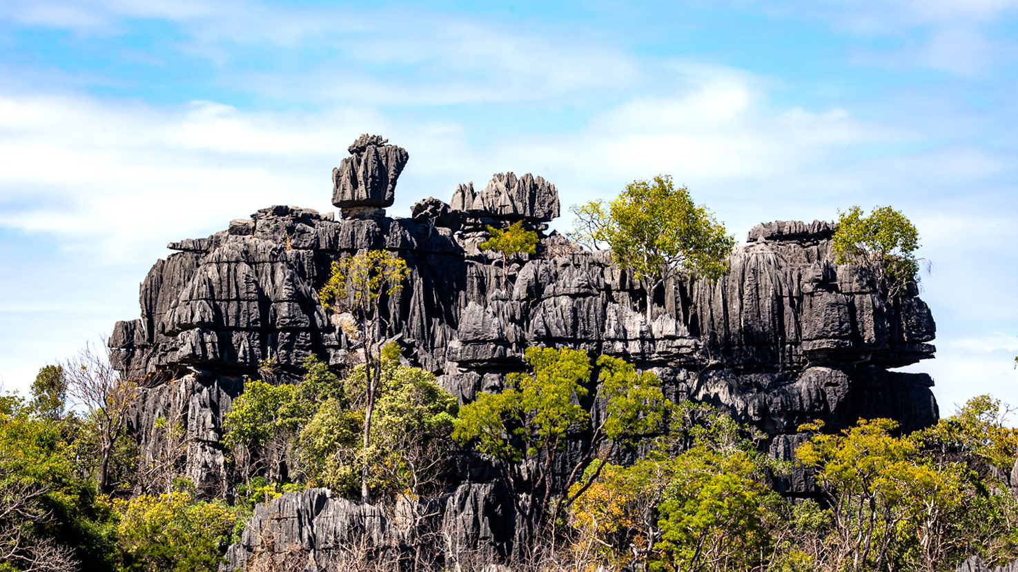
Geography and landscapes of the park
Namoroka National Park lies in the Boeny region of north‑western Madagascar, inland, south of Soalala and west of Mahajanga/Majunga.
- Ecosystems: limestone tsingy, canyons, caves, dry deciduous forest and shrubby savanna
- Area: approximately 220 km² (22,000 ha)
- Altitude: around 100–300 m
- Relief: limestone plateau deeply incised into tsingy pinnacles, gorges, sinkholes and cavities
- Climate: dry tropical, with a rainy season (November–March) and a long dry season (April–October)
Namoroka’s “stone forests” are compact and very sharp, with razor‑edged ridges and many narrow corridors. Vegetation concentrates in pockets: denser at the bottom of depressions and canyons, while the upper plateaus remain more open and very exposed to the sun.
Trails and circuits
Access typically involves a 4×4 journey to the park’s boundaries, followed by guided exploration on foot:
Tsingy and limestone plateau
Routes on the plateau, with passages over exposed ridges and viewpoints over the karst landscape.
Canyon and sinkhole trails
Paths that descend into cooler, shaded gorges where vegetation is denser and humidity higher.
Caves and galleries
Guided visits to selected caves with stalactites, stalagmites, bat colonies and sometimes underground water. Some sites are subject to fady (local taboos) and may be inaccessible.
Many circuits are technical, with very sharp rock, narrow passages and uneven terrain; good shoes, balance and reasonable fitness are essential.
Wildlife
Namoroka National Park harbours fauna typical of western dry forests, with several localised and endemic species:
- Lemurs: brown lemurs, dry‑forest‑adapted sifakas and nocturnal lemurs such as mouse lemurs (Microcebus), dwarf lemurs (Cheirogaleus) and woolly lemurs (Avahi)
- Birds: dry‑forest and tsingy‑specialist species (vangas, couas, raptors and cave‑associated birds)
- Reptiles: chameleons, geckos and non‑venomous snakes adapted to rocky environments
- Cave fauna: bats and specialised invertebrates, with some aquatic species in underground pools
Flora and vegetation
The vegetation of Namoroka National Park reflects strong adaptation to drought and limestone substrates:
- Dry deciduous forest: trees that lose their leaves during the dry season, with a shrubby understorey
- Tsingy vegetation: plants growing in rock fissures, including succulents, euphorbias and drought‑resistant shrubs
- Canyon and sinkhole forests: denser, greener vegetation in humid micro‑habitats at the bottom of gorges
This contrast between exposed rock and sheltered vegetation creates a mosaic of habitats over a relatively small area.
Ecological and cultural importance
- Conservation: Namoroka National Park protects an important tsingy complex and dry‑forest ecosystems in north‑western Madagascar, complementary to other karst reserves in the region.
- Cultural value: some caves and rock formations are sacred to local communities and governed by fady that visitors must respect.
- Threats: fires, overgrazing and timber extraction at the park’s periphery exert constant pressure on the ecosystem.
Access and best time to visit
The park is about 300 km north‑west of Mahajanga/Majunga (2 days on a 4×4 track) via Soalala, inland, south of Soalala.
Best period from May to October, during the dry season, when tracks are more passable and access to the tsingy massif is realistic.
From November to April, rains can make tracks very difficult or impassable, heat and humidity increase and park access may be compromised.
Practical tips
- Wear closed, very sturdy hiking shoes: sharp limestone and irregular rocks lead to cuts and sprains
- Carry plenty of water, a hat and strong sun protection; shade is limited on the plateau
- Bring a headlamp for caves and possible evening delays, plus gloves if you are sensitive to sharp rock
- Allow one or two extra days in your schedule in case of track or weather delays
Conclusion
Quieter and more isolated than Madagascar’s big flagship parks, Namoroka National Park will win over travellers seeking solitude, rugged terrain and authentic exploration. Its tsingy, hidden canyons and cave systems, combined with wildlife typical of dry forests, offer a powerful sense of discovery for those who accept the demanding journey and rustic conditions.